(Zacatecas Silver, 19.Apr.2021) — Zacatecas Silver Corp. completed first pass geological and structural mapping, and reconnaissance rock-chip geochemical sampling of the San Gill Breccia Zone. San Gill is located in the southern part of the main Zacatecas concessions and is approximately 2 kilometers to the southwest of the Veta Grande vein.
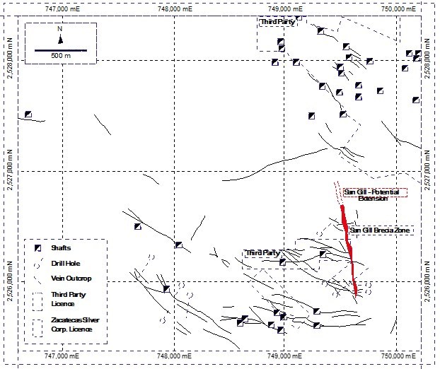
Highlights: 1) North-south zone of ferruginous breccia averaging 20-40 meters wide defined over a strike length of more than 800 meters on surface, 2) The breccia zone is strongly anomalous in silver, gold, zinc and arsenic at surface, with increasing geochemical anomalism towards the north, where the zone passes under thin Quaternary soil cover, 3) Structural analysis indicates the zone is a nest of broadly north-south striking faults that dip moderately to steeply towards the east. The structure is possibly of the same age and affinity as the gold-bearing El Orito fault system mined in the southern part of the Zacatecas district, 4) Our revised interpretation of the gross dip of the zone means that over 600 meters of strike length of the northern, more geochemically anomalous segment of the breccia remains untested by previous drilling, and 5) The company is actively planning a drill program to test the highly prospective and untested northern segment of the breccia in the coming months.
____________________